

Introduction
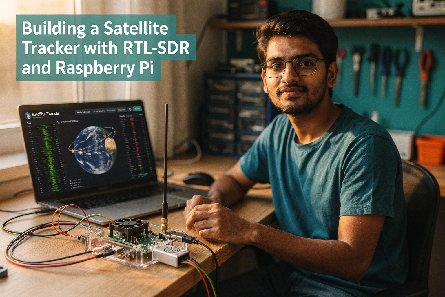
The growing trend of satellite communication in India has created an exciting opportunity for engineering students to get hands-on experience with real-world space technology. Building your own satellite tracker is not just an impressive project for your portfolio—it's a gateway to understanding orbital mechanics, signal processing, and embedded systems.
With India's ambitious space missions like Chandrayaan and Gaganyaan gaining momentum, and the rapid expansion of satellite-based services like JioSpaceFiber and Airtel's satellite internet, understanding satellite tracking has become more relevant than ever. This guide will walk you through building a functional satellite tracker using affordable RTL-SDR hardware and a Raspberry Pi, perfect for students at engineering colleges across India.
Components Required
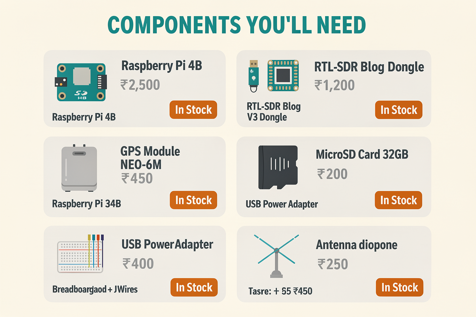
Here's everything you'll need to build your satellite tracker. All components are available at TecnoMate stores across major Indian cities.
| Component | Specification | Price (₹) | Availability |
|---|---|---|---|
| Raspberry Pi 4B | 2GB/4GB, WiFi/Bluetooth | 2,500 | In Stock |
| RTL-SDR Blog V3 Dongle | 2.4GHz-1.76GHz frequency range | 1,200 | In Stock |
| GPS Module | NEO-6M, 3.3V | 450 | In Stock |
| Raspberry Pi Case | Transparent with cooling fan | 350 | In Stock |
| MicroSD Card | 32GB, Class 10, A1 | 200 | In Stock |
| USB Power Adapter | 5V 3A | 400 | In Stock |
| Breadboard + Jumper Wires | Standard size | 250 | In Stock |
| Antenna | Simple dipole 2m | 150 | In Stock |
Total Estimated Cost: ₹5,500
Understanding the Technology
What is RTL-SDR?
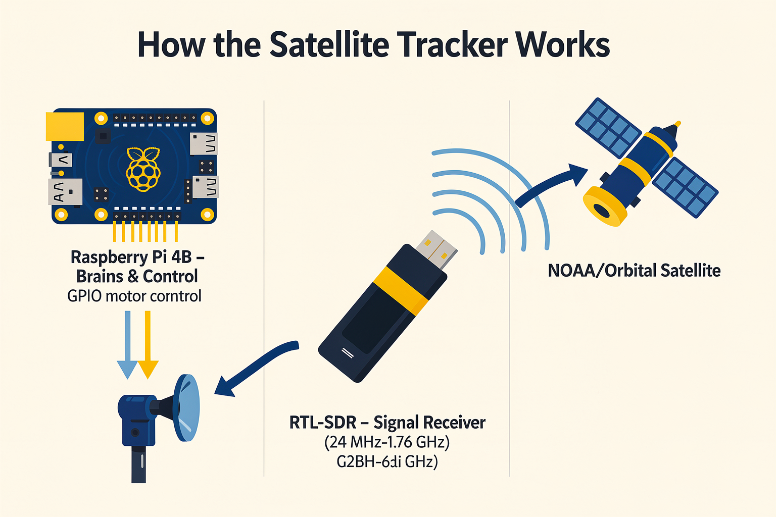
The RTL-SDR (Real-Time Digital Software Defined Radio) is a revolutionary device that turns your computer or single-board computer into a powerful radio receiver. Based on the RTL2832U chipset from Realtek, it can tune into frequencies from 24 MHz to 1.76 GHz, making it perfect for receiving satellite downlinks.
How Raspberry Pi Fits In
The Raspberry Pi serves as the brains of our satellite tracker system. Its GPIO pins allow for precise motor control to adjust the antenna position, while its processing power handles the complex calculations needed for orbit prediction and signal processing.
Satellite Tracking Basics
Satellites orbit Earth at speeds of approximately 7.8 km/s. To track them, we need to:
- Predict the satellite's position using TLE (Two-Line Element) data
- Calculate the elevation, azimuth, and range from our position
- Control an antenna to point at the satellite
- Detect and decode the satellite signal
Setting Up the Hardware
Physical Installation
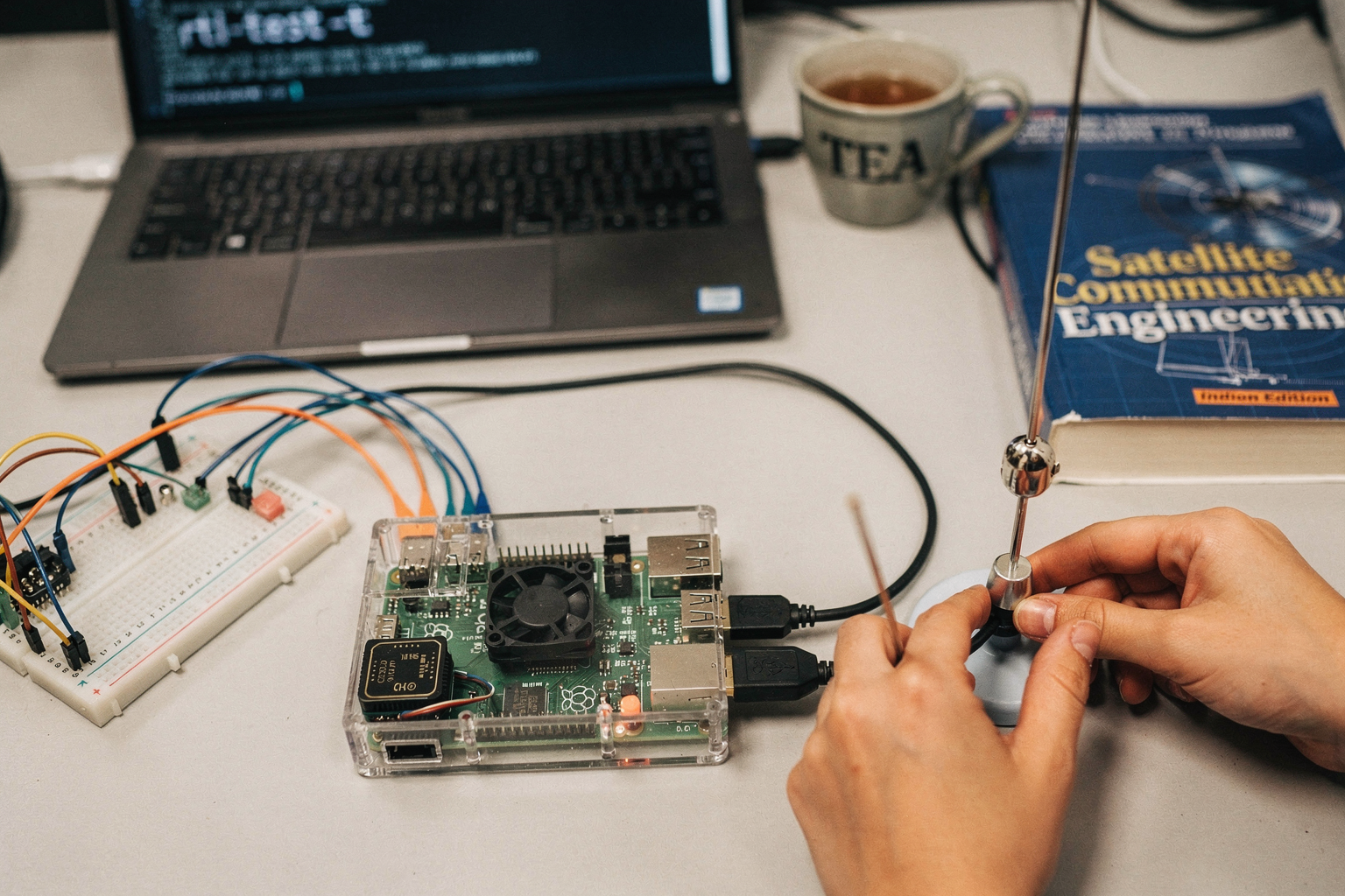
- Mount the Raspberry Pi in its case with the cooling fan activated
- Connect the RTL-SDR dongle to a USB port
- Attach the GPS module to GPIO pins using jumper wires:
- GPS VCC → Raspberry Pi 3.3V
- GPS GND → Raspberry Pi GND
- GPS TX → Raspberry Pi GPIO15
- GPS RX → Raspberry Pi GPIO14
Software Installation on Raspberry Pi
First, update your system:
sudo apt update && sudo apt upgrade -y
Install required packages:
sudo apt install git python3-pip python3-dev -y
cd /tmp
git clone https://github.com/EUTELSAT/rtlsdr.git
cd rtlsdr
sudo apt-get install librtlsdr-dev -y
sudo make && sudo make install
sudo ldconfig
cd /tmp
sudo pip3 install rtlsdr numpy scipy matplotlib ephem gpsd-py3
Step-by-Step Implementation
Installing RTL-SDR Drivers
The RTL-SDR drivers are crucial for proper functionality:
# Create workspace directory
mkdir -p ~/satellite-tracker
cd ~/satellite-tracker

# Install rtl-sdr tools
sudo apt install rtl-sdr -y

# Configure RTL-SDR gain
sudo rtl_test -t
Configuring the Software
Create a configuration file for your tracking parameters:
# config.py
import os
import json

CONFIG = {
    "satellite_name": "NOAA-15",
    "tle_lines": [
        "1 25544U 98067A   17215.51782528 -.00002182  00000-0 -11606-4 0  2927",
        "2 25544  98.1916 251.7707 0006703 130.5361 224.8618 15.54062528563527"
    ],
    "receiver_gain": 40,
    "sampling_rate": 2048000,
    "center_frequency": 401500000,
    "latitude": 28.6139,  # New Delhi
    "longitude": 77.2090,
    "altitude": 200
}

def save_config(config):
    with open('satellite_config.json', 'w') as f:
        json.dump(config, f, indent=2)

def load_config():
    if os.path.exists('satellite_config.json'):
        with open('satellite_config.json', 'r') as f:
            return json.load(f)
    return CONFIG
Building the Tracking Algorithm
The core tracking logic involves calculating satellite positions and controlling antenna movement:
# tracker.py
import numpy as np
import ephem
import time
import json
from config import load_config, save_config
import rtlsdr

class SatelliteTracker:
    def __init__(self):
        self.config = load_config()
        self.setup_satellite()

    def setup_satellite(self):
        self.sat = ephem.readtle(self.config['satellite_name'],
                                self.config['tle_lines'][0],
                                self.config['tle_lines'][1])

    def get_satellite_position(self):
        observer = ephem.Observer()
        observer.lat = str(self.config['latitude'])
        observer.lon = str(self.config['longitude'])
        observer.elevation = self.config['altitude']
        observer.date = ephem.now()

        self.sat.compute(observer)

        return {
            'azimuth': float(ephem.degrees(self.sat.az)),
            'elevation': float(ephem.degrees(self.sat.alt)),
            'range': float(observer.geo_distance(self.sat) * 1000)  # in meters
        }

    def setup_rtl_sdr(self):
        self.sdr = rtlsdr.RtlSdr()
        self.sdr.sample_rate = self.config['sampling_rate']
        self.sdr.center_freq = self.config['center_frequency']
        self.sdr.gain = self.config['receiver_gain']

    def monitor_signal(self):
        self.setup_rtl_sdr()
        print("Monitoring satellite signal...")

        while True:
            try:
                samples = self.sdr.read_samples(2048*100)

                # Simple signal detection
                power = np.mean(np.abs(samples)**2)
                print(f"Signal Power: {power:.2f}")

                if power > 1000:  # Threshold for signal detection
                    azimuth = self.get_satellite_position()['azimuth']
                    elevation = self.get_satellite_position()['elevation']
                    print(f"Satellite at Azimuth: {azimuth:.2f}°, Elevation: {elevation:.2f}°")

                    # Save position for antenna control
                    self.save_antenna_position(azimuth, elevation)

            except KeyboardInterrupt:
                self.sdr.close()
                break

    def save_antenna_position(self, azimuth, elevation):
        position = {
            'timestamp': time.time(),
            'azimuth': azimuth,
            'elevation': elevation
        }
        with open('satellite_position.json', 'w') as f:
            json.dump(position, f)
Real-World Applications and Career Opportunities

Educational Value
This project teaches you:
- Orbital mechanics and TLE data interpretation
- Signal processing and digital communications
- Embedded systems programming
- Python programming for scientific applications
Future Career Opportunities in India
The Indian space sector is experiencing unprecedented growth with:
- ISRO's commercial arm (NSIL) expanding
- Private companies like Skyroot Aerospace and Pixxel planning launches
- Government initiatives like Digital India relying on satellite connectivity
- Telecom operators investing heavily in satellite-based services
Proficiency in satellite tracking and communication systems opens doors to careers in:
- ISRO and its commercial ventures
- Private space startups
- Defense and aerospace companies
- Telecommunications companies
Troubleshooting
| Problem | Possible Cause | Solution |
|---|---|---|
| RTL-SDR not detected | USB driver issue | Run lsusb to check, reinstall drivers |
| Poor signal quality | Incorrect gain setting | Adjust gain between 20-60 dB |
| GPS module not working | Wiring errors | Check TX/RX connections and baud rate |
| High CPU usage | Inefficient code | Optimize loops, use numpy arrays |
| Satellite position inaccurate | Wrong TLE data | Update TLE data from CelesTrak |
| Antenna not moving | GPIO or motor issues | Check motor driver circuit and GPIO pins |
Common Pitfalls and How to Avoid Them
-
Power Issues: The Raspberry Pi and RTL-SDR together draw significant power. Always use a high-quality 5V 3A power supply.
-
Antenna Placement: Keep the antenna away from metal objects and the Pi's WiFi antenna to avoid interference.
-
Satellite Selection: Start with NOAA satellites (15, 18, 19) as they transmit in the 136-137 MHz range and have strong signals.
-
Location Accuracy: Use accurate coordinates for your location. Even small errors can result in tracking errors of several degrees.
Frequently Asked Questions
No, this tracker is designed for receiving satellite signals, not transmitting. For two-way communication, you'd need more advanced equipment and proper licensing from TRAI and WPC.
Ready to start building?
Explore our collection of DIY kits and components. All project components mentioned in this blog are available in our store.
Browse All Projects